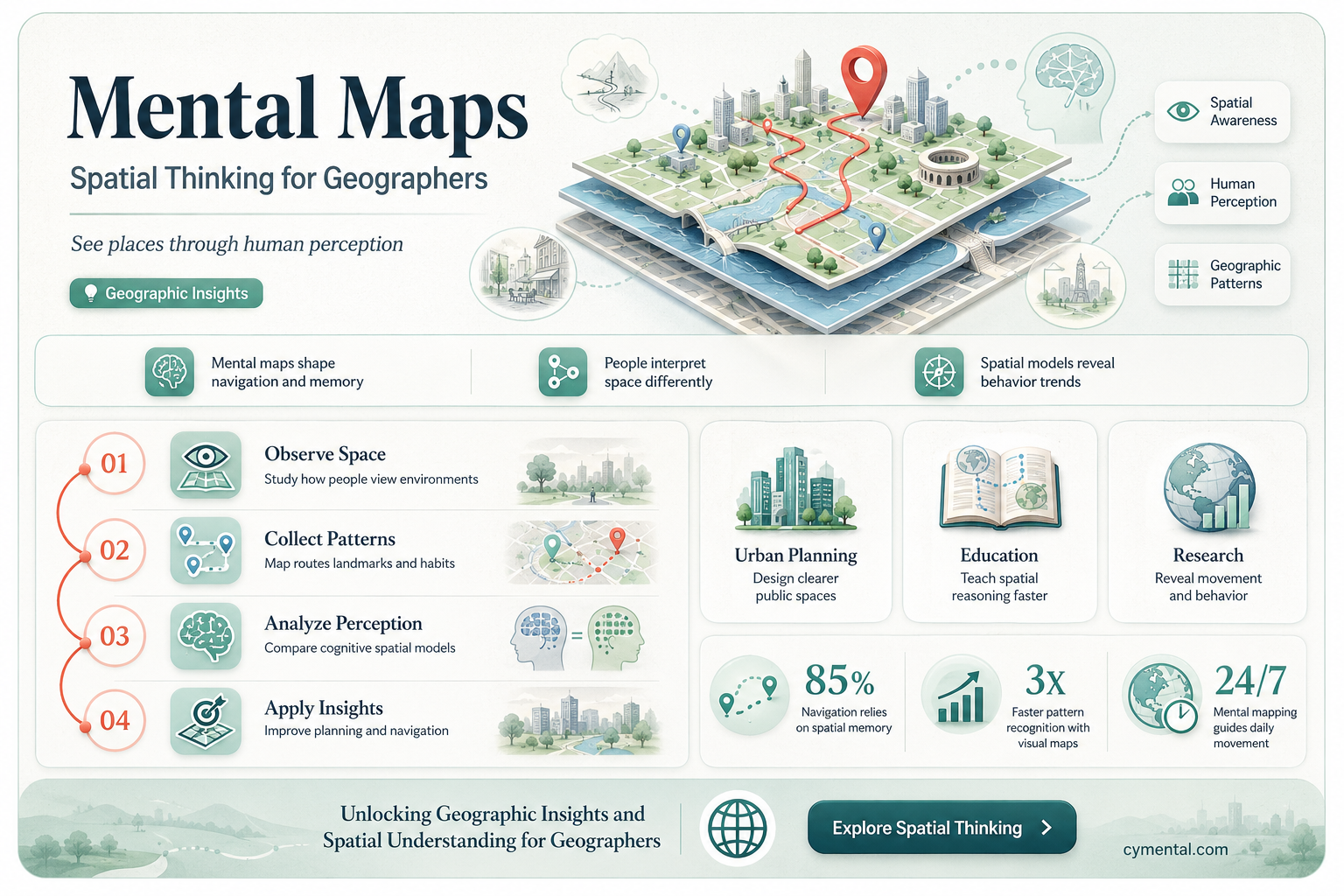
Mental maps are invaluable tools for geographers as they provide a visual representation of an individual’s cognitive understanding of spatial relationships, often revealing subjective perceptions of places, distances, and landmarks. By analyzing these mental maps, geographers can gain insights into how people interpret and interact with their environment, identify cultural biases, and understand the influence of personal experiences on spatial awareness. This helps geographers study human geography, urban planning, and behavioral patterns, while also highlighting gaps between perceived and actual spatial realities. Ultimately, mental maps serve as a bridge between subjective human perception and objective geographical analysis, enriching the field’s understanding of how space is experienced and conceptualized.
| Characteristics | Values |
|---|---|
| Spatial Understanding | Mental maps help geographers understand how individuals perceive and organize spatial information, revealing cognitive representations of the environment. |
| Human-Environment Interaction | They provide insights into how people interact with their surroundings, including cultural, social, and economic influences on spatial awareness. |
| Decision-Making | Geographers use mental maps to study how individuals make decisions based on their spatial knowledge, such as route planning or resource allocation. |
| Urban Planning | Mental maps assist in urban planning by identifying how residents perceive and navigate urban spaces, informing design and infrastructure improvements. |
| Cultural Geography | They highlight cultural differences in spatial cognition, showing how cultural backgrounds shape perceptions of places and landscapes. |
| Wayfinding and Navigation | Mental maps are crucial for understanding how people navigate unfamiliar areas, aiding in the development of intuitive mapping and navigation tools. |
| Environmental Perception | Geographers analyze mental maps to study how individuals perceive environmental features, such as landmarks, terrain, and natural resources. |
| Behavioral Geography | They provide a foundation for studying human behavior in spatial contexts, including mobility patterns and territoriality. |
| Education and Learning | Mental maps are used to assess geographic literacy and improve educational strategies for teaching spatial concepts. |
| Policy and Resource Management | Understanding mental maps helps in formulating policies related to land use, conservation, and resource management by considering local spatial perceptions. |
Explore related products


$17.29 $29.99


What You'll Learn
- Spatial Understanding: Mental maps aid in visualizing and interpreting spatial relationships and geographic patterns
- Data Interpretation: They help geographers analyze and organize complex geographic data efficiently
- Field Research: Mental maps assist in navigating and documenting observations during fieldwork
- Urban Planning: They guide the design and improvement of cities based on spatial awareness
- Cultural Insights: Mental maps reveal how people perceive and interact with their environments
![]()
Spatial Understanding: Mental maps aid in visualizing and interpreting spatial relationships and geographic patterns
Mental maps serve as cognitive tools that allow geographers to internalize and manipulate spatial information, transforming abstract data into tangible, understandable landscapes. By mentally plotting elements like roads, landmarks, and boundaries, geographers can identify patterns such as urban sprawl, migration routes, or resource distribution. For instance, a mental map of a city might reveal how neighborhoods cluster by socioeconomic status, offering insights into historical development or contemporary planning challenges. This ability to visualize spatial relationships enables geographers to interpret complex geographic phenomena without relying solely on physical maps or digital tools.
To harness the power of mental maps for spatial understanding, geographers can follow a structured approach. Start by gathering detailed data on the area of interest, including topography, infrastructure, and demographic information. Next, sketch a rough mental map, focusing on key features and their relative positions. Practice recalling this map periodically, refining its accuracy over time. Caution against overloading the map with details initially; prioritize major elements before adding secondary features. For example, when mapping a river system, begin with the main channel and tributaries before incorporating smaller streams or surrounding land use. This methodical process enhances spatial cognition and fosters a deeper understanding of geographic patterns.
Consider the comparative advantage of mental maps in fieldwork. Unlike static maps or GPS devices, mental maps dynamically adapt to new observations, allowing geographers to integrate real-time data seamlessly. For instance, while conducting a land-use survey, a geographer might notice an unexpected industrial zone encroaching on agricultural land. By updating their mental map on the spot, they can immediately assess the spatial implications—such as altered drainage patterns or increased pollution—and adjust their research focus accordingly. This flexibility makes mental maps indispensable for on-the-ground analysis.
Persuasively, mental maps bridge the gap between theoretical knowledge and practical application in geography. They enable geographers to "think spatially," a skill critical for solving real-world problems like disaster response or urban planning. For example, during a flood, a mental map of a city’s elevation and drainage systems can guide evacuation routes or resource allocation more intuitively than consulting a physical map under time pressure. By internalizing spatial relationships, geographers can act decisively, translating their understanding into actionable strategies that mitigate risks and optimize outcomes.
Descriptively, mental maps are not just tools for individual geographers but also serve as cultural artifacts reflecting collective spatial understanding. Indigenous communities, for instance, often possess mental maps of their territories that encode ecological knowledge, sacred sites, and seasonal resource availability. These maps, passed down through generations, demonstrate how spatial understanding shapes cultural practices and vice versa. For geographers studying human-environment interactions, analyzing such mental maps provides a lens into sustainable land management practices and the resilience of traditional knowledge systems. This intersection of cognition and culture underscores the broader significance of mental maps in geographic research.
Reporting Mental Health Associations: When Help Falls Short, What Next?
You may want to see also
Explore related products


![]()
Data Interpretation: They help geographers analyze and organize complex geographic data efficiently
Geographers often grapple with vast, multifaceted datasets that can overwhelm even the most seasoned professionals. Mental maps serve as cognitive frameworks, enabling them to distill complex geographic information into manageable, interpretable patterns. By visualizing spatial relationships and distributions, geographers can identify trends, anomalies, and correlations that might otherwise remain hidden in raw data. For instance, a mental map of urban land use can reveal how industrial zones cluster near transportation hubs, a pattern that informs urban planning decisions. This ability to simplify complexity is not just a convenience—it’s a necessity in a field where data often spans multiple scales, from local neighborhoods to global ecosystems.
Consider the process of analyzing demographic data across a region. Without a mental map, a geographer might struggle to connect population density, income levels, and infrastructure access into a coherent narrative. However, by overlaying these variables onto a cognitive spatial framework, they can quickly discern how socioeconomic factors align with geographic features. For example, a mental map might highlight how low-income areas are disproportionately located in floodplains, a critical insight for disaster risk management. This approach transforms data interpretation from a mechanical task into a dynamic, insightful process, where spatial context enriches numerical information.
To leverage mental maps effectively, geographers should follow a structured approach. First, identify the key variables in the dataset and their spatial dimensions. Next, sketch a rough mental map, focusing on the relationships between these variables. Then, iteratively refine the map by incorporating additional data layers, ensuring each element contributes to a clearer understanding of the geographic phenomena. Caution must be taken to avoid oversimplification—mental maps should enhance, not distort, the data. For instance, while a mental map might suggest a correlation between deforestation and agricultural expansion, it’s essential to validate this with empirical evidence. This balance between intuition and rigor ensures mental maps remain a reliable tool for data interpretation.
The persuasive power of mental maps lies in their ability to bridge the gap between abstract data and tangible geographic reality. They allow geographers to communicate complex findings in a visually intuitive way, making them invaluable in both research and policy contexts. For example, a mental map illustrating the spread of invasive species can persuade stakeholders of the urgency for conservation efforts more effectively than a spreadsheet of coordinates. By translating data into spatial narratives, mental maps not only aid analysis but also amplify the impact of geographic research, driving informed decision-making in fields ranging from environmental science to urban development.
Jehovah's Witnesses and Mental Health: Seeking Professional Help or Faith Alone?
You may want to see also
Explore related products


![]()
Field Research: Mental maps assist in navigating and documenting observations during fieldwork
Mental maps, the cognitive representations of spatial environments, serve as indispensable tools for geographers conducting field research. By mentally charting landscapes, researchers can navigate unfamiliar terrains with greater efficiency, reducing reliance on physical maps or digital devices. This internalized spatial understanding allows for seamless movement between sites, ensuring that time in the field is maximized for data collection rather than orientation. For instance, a geographer studying urban sprawl in a rapidly developing city might use a mental map to quickly locate boundary zones between residential and industrial areas, streamlining their observational workflow.
The process of creating and updating mental maps during fieldwork also enhances observational accuracy. As researchers traverse an area, they subconsciously note landmarks, spatial relationships, and environmental changes, which are then integrated into their cognitive map. This dynamic documentation method fosters a deeper connection with the study site, enabling geographers to identify subtle patterns or anomalies that might otherwise be overlooked. For example, a researcher mapping coastal erosion could use their mental map to correlate the position of sand dunes with tidal patterns, enriching their field notes with spatially informed insights.
However, the utility of mental maps in fieldwork is not without its challenges. Over-reliance on cognitive mapping can lead to oversights, particularly in complex or rapidly changing environments. Geographers must balance mental mapping with traditional documentation methods, such as GPS tracking or handwritten notes, to ensure data integrity. Additionally, mental maps are inherently subjective, reflecting the researcher’s perspective and biases. To mitigate this, field researchers should periodically cross-reference their mental maps with physical data, validating their spatial understanding against objective measurements.
Practical tips for leveraging mental maps in fieldwork include starting with a basic sketch of the study area before entering the field, which provides a framework for cognitive mapping. Researchers should also practice active observation, consciously noting key features and spatial relationships as they move through the environment. For long-term projects, maintaining a field journal to record updates to the mental map can help track changes over time. By integrating these strategies, geographers can harness the power of mental maps to navigate and document their observations with precision and depth.
Brain Scans and Mental Health: Unlocking Diagnostic Potential for Illnesses
You may want to see also
Explore related products


![]()
Urban Planning: They guide the design and improvement of cities based on spatial awareness
Mental maps, the cognitive representations of physical spaces, serve as invaluable tools for urban planners in shaping the design and improvement of cities. By understanding how residents perceive and navigate their environment, planners can identify areas of confusion, inefficiency, or underutilization. For instance, a mental map study might reveal that a particular intersection is consistently perceived as chaotic and unsafe, prompting planners to redesign traffic flow or enhance pedestrian infrastructure. This approach ensures that urban interventions are not just aesthetically pleasing but also functionally aligned with the spatial awareness of the community.
Consider the process of creating a mental map for urban planning: first, gather data through surveys, interviews, or participatory mapping exercises. Ask residents to sketch their daily routes, highlight important landmarks, or identify problem areas. Next, analyze these maps for patterns—do multiple participants avoid a certain street? Is a park underutilized despite its central location? These insights provide a foundation for evidence-based decision-making. For example, if a mental map study shows that a neighborhood lacks accessible green spaces, planners can prioritize the development of parks or community gardens in that area, addressing a tangible need.
However, relying solely on mental maps carries risks. Individual perceptions can be biased or incomplete, and what one person views as a problem might be insignificant to another. To mitigate this, planners must triangulate mental map data with quantitative metrics, such as traffic flow analysis or land use surveys. Additionally, engaging diverse demographic groups—including children, elderly residents, and marginalized communities—ensures that the spatial awareness of all stakeholders is considered. For instance, a mental map study in a multi-generational neighborhood might reveal that seniors avoid certain sidewalks due to poor lighting, while younger residents prioritize bike lanes. Balancing these perspectives fosters inclusive urban design.
The practical application of mental maps in urban planning extends beyond problem-solving to proactive design. For example, in designing a new transit system, planners can use mental maps to predict how residents will integrate the system into their daily routines. Will commuters perceive the new routes as convenient, or will they stick to familiar paths? By simulating these scenarios, planners can optimize station locations, signage, and connectivity to encourage adoption. Similarly, when revitalizing a downtown area, mental maps can guide the placement of cultural hubs or retail spaces to align with residents’ spatial habits, ensuring the area becomes a vibrant, well-used part of the city.
In conclusion, mental maps are not just theoretical constructs but actionable blueprints for urban planners. They bridge the gap between objective spatial data and subjective human experience, enabling cities to evolve in ways that resonate with their inhabitants. By incorporating mental maps into the planning process, cities can become more navigable, inclusive, and responsive to the needs of their residents. Whether addressing existing challenges or envisioning future developments, mental maps provide a human-centered lens that transforms spatial awareness into tangible urban improvements.
Can School Counselors Seek Mental Health Support? Exploring Eligibility and Resources
You may want to see also
Explore related products


![]()
Cultural Insights: Mental maps reveal how people perceive and interact with their environments
Mental maps, the cognitive representations of spatial environments, offer geographers a unique lens into the cultural fabric of communities. By analyzing these mental constructs, researchers can decipher how individuals and groups perceive, organize, and interact with their surroundings. For instance, a study in urban planning might reveal that residents of a city consistently omit certain neighborhoods from their mental maps, indicating social or economic barriers that fragment the community. This insight is invaluable for policymakers seeking to foster inclusivity and connectivity.
Consider the process of creating a mental map as a cultural act. When asked to sketch their city, people often prioritize landmarks that hold personal or collective significance—a historic church, a bustling market, or a childhood park. These choices reflect not just spatial awareness but also emotional and cultural attachments. Geographers can use this data to identify areas of cultural importance, ensuring that urban development preserves rather than erases community identity. For example, a mental map study in a rapidly gentrifying area might highlight local businesses or cultural hubs that residents fear losing, guiding more sensitive urban renewal efforts.
To harness the power of mental maps, geographers must employ careful methodologies. One effective approach is participatory mapping, where community members are actively involved in creating their mental maps. This not only yields richer data but also empowers participants to articulate their spatial experiences. For instance, in rural communities, participatory mapping can reveal how indigenous knowledge systems shape land use and resource management, offering insights that quantitative data alone cannot capture. However, researchers must be mindful of biases—mental maps are subjective, and factors like age, gender, and socioeconomic status can influence their accuracy and detail.
A compelling example of mental maps in action is their use in cross-cultural comparisons. Studies have shown that mental maps of Western city dwellers often emphasize grid-like structures and individual landmarks, reflecting a culture that values order and personal space. In contrast, mental maps from collectivist societies may focus on communal spaces and relational distances, mirroring a cultural emphasis on interconnectedness. Such comparisons not only deepen our understanding of cultural differences but also challenge geographers to rethink universal assumptions about spatial cognition.
In practical terms, mental maps can inform everything from disaster response to tourism development. During emergencies, understanding how residents mentally navigate their environment can improve evacuation routes and aid distribution. In tourism, mental maps of visitors versus locals can highlight cultural misunderstandings or untapped attractions. For instance, tourists might overlook a vibrant local art scene not prominently featured in their mental maps, while residents may undervalue historical sites taken for granted. By bridging these perceptual gaps, geographers can enhance both community resilience and economic opportunities.
Ultimately, mental maps serve as cultural barometers, measuring how deeply environment and identity are intertwined. They remind geographers that space is not just physical but also psychological and social. By studying these cognitive landscapes, researchers can uncover hidden patterns of perception and behavior, fostering more culturally attuned approaches to planning, policy, and community engagement. In a world increasingly shaped by globalization and urbanization, mental maps offer a vital tool for preserving and understanding the diverse ways people experience place.
Can You Require a Spouse to Seek Mental Health Treatment?
You may want to see also
Frequently asked questions
Mental maps are cognitive representations of spatial environments stored in a person's mind. They help geographers understand how individuals perceive and organize geographic information, such as locations, distances, and landmarks, based on personal experiences and knowledge.
Mental maps provide insights into how people interact with their environment, revealing patterns of movement, preferences, and cultural influences. Geographers use this information to analyze human behavior, urban planning, and spatial decision-making.
Yes, mental maps often reflect personal biases, stereotypes, or limited knowledge about certain areas. Geographers study these biases to understand how they shape perceptions of places and influence spatial behaviors.
By analyzing mental maps, geographers can identify how residents perceive and use urban spaces. This helps in designing more efficient transportation systems, public spaces, and infrastructure that align with community needs and behaviors.
Yes, mental maps are valuable tools in geography education. They help teachers assess students' spatial understanding, identify misconceptions, and improve their ability to interpret and analyze geographic information.